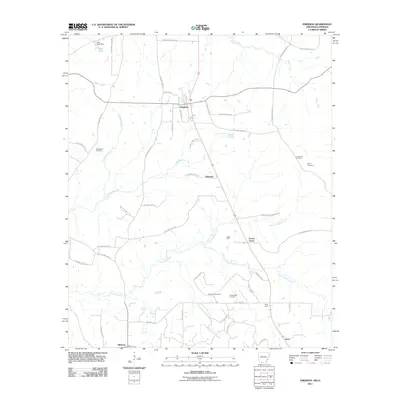
2011 Map of Emerson
USGS Topo · Published 2011About this map
Emerson serves as the central hub of this borderland landscape, where the northern Arkansas timberlands meet the energy-producing regions of the Louisiana state line. The map reveals an area defined by its hydraulic and mineral resources, from Sale Lake Dam in the northwest to the extensive Horsehead Oil Field. A complex network of county roads and named spurs, such as Oilfield Spur and Rucks Spur, indicates a legacy of industrial transport and rural access. Small communities and named locales like Mohawk, Forest Grove, and Millerton are interspersed among the winding tributaries of Little Cypress Creek and North Cypress Creek. For the local historian, the presence of Providence Cemetery, Anderson Cemetery, and Elliott Cemetery offers specific points of interest for genealogical research within this quiet corner of Columbia County.
Find a feature on this map
54 named features on this map. Tap any name to fly to it.
Don’t see what you’re looking for? This feature index may not catch every label — zoom into the map to look around manually.
Map Details
Editions of this 2011 Emerson Map
This is the sole edition of this map. No revisions or reprints were ever made.
Other maps of this area

1922 · Sarepta
USGS Topo · 1:62,500

1924 · Sarepta
USGS Topo · 1:62,500

1952 · Homer
USGS Topo · 1:62,500

1953 · El Dorado
USGS Topo · 1:250,000

1955 · Shreveport
USGS Topo · 1:250,000

1956 · Shreveport
USGS Topo · 1:250,000

1956 · Sarepta
USGS Topo · 1:62,500

1957 · El Dorado
USGS Topo · 1:250,000

1958 · El Dorado
USGS Topo · 1:250,000

1960 · El Dorado
USGS Topo · 1:250,000