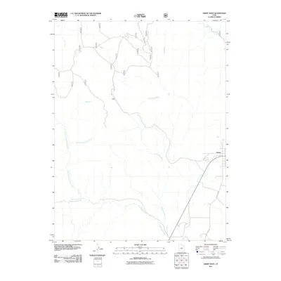
2011 Map of Emery West
USGS Topo · Published 2011About this map
Emery sits at the edge of a high-desert drainage system, where the town's geography is defined by the convergence of several major seasonal waterways. The landscape to the west is dominated by the massive erosion patterns of Link Canyon and Link Canyon Wash, which channel runoff toward the southern reaches of the quadrangle. Transport and industry in the region are clearly marked by the presence of Coal Mine Rd, reflecting the area's long-standing connection to resource extraction and the logistical needs of moving materials through the varied terrain. In the northern and eastern portions, Muddy Creek and Wileys Fork cut through the topography, while the complex network of Quitchupah Creek and its north and east forks illustrate the intricate hydrological layout of the Emery County foothills during this period.
Find a feature on this map
11 named features on this map. Tap any name to fly to it.
Don’t see what you’re looking for? This feature index may not catch every label — zoom into the map to look around manually.
Map Details
Editions of this 2011 Emery West Map
This is the sole edition of this map. No revisions or reprints were ever made.
Other maps of this area

1885 · Manti
USGS Topo · 1:250,000

1885 · Fish Lake
USGS Topo · 1:250,000

1895 · Manti
USGS Topo · 1:250,000

1896 · Fish Lake
USGS Topo · 1:250,000

1922 · Wasatch
USGS Topo · 1:31,680

1923 · Castle Dale
USGS Topo · 1:62,500

1925 · Castle Dale
USGS Topo · 1:62,500

1925 · Acord Lakes
USGS Topo · 1:62,500

1956 · Salina
USGS Topo · 1:250,000

1956 · Price
USGS Topo · 1:250,000