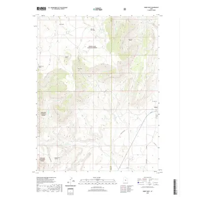
2020 Map of Emery West
USGS Topo · Published 2020About this map
The town of Emery sits at the edge of a dramatic transition where the agricultural valley meets the rising elevation of the Wasatch Plateau. This 2020 map documents the complex drainage systems that have carved the landscape, including Quitchupah Cr and Muddy Cr, which flow through deeply incised features like Box Canyon and Link Canyon. The western portion of the quadrangle is dominated by protected public lands, shared between the Manti-La Sal National Forest and the Fishlake National Forest. Local infrastructure is defined by the proximity of the resource economy, evidenced by Coal Mine Rd and the Quitchupah Road. Genealogists and local historians will find the Emery Cem clearly marked on the northern outskirts of the settlement, while the terrain's rugged nature is illustrated by the Wildcat Knolls and the broad Water Hollow Benches.
Find a feature on this map
30 named features on this map. Tap any name to fly to it.
Don’t see what you’re looking for? This feature index may not catch every label — zoom into the map to look around manually.
Map Details
Editions of this 2020 Emery West Map
This is the sole edition of this map. No revisions or reprints were ever made.
Other maps of this area

1885 · Manti
USGS Topo · 1:250,000

1885 · Fish Lake
USGS Topo · 1:250,000

1895 · Manti
USGS Topo · 1:250,000

1896 · Fish Lake
USGS Topo · 1:250,000

1922 · Wasatch
USGS Topo · 1:31,680

1923 · Castle Dale
USGS Topo · 1:62,500

1925 · Castle Dale
USGS Topo · 1:62,500

1925 · Acord Lakes
USGS Topo · 1:62,500

1956 · Salina
USGS Topo · 1:250,000

1956 · Price
USGS Topo · 1:250,000