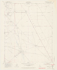
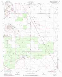
1953 Map of Emigrant Hill
USGS Topo · Published 1965About this map
The Devils Den Oil Field anchor the northwest corner of this terrain, where industrial extraction meets the arid expanses of the Antelope Plain. This mid-century survey captures an era of infrastructure development in Kern County, marked by the presence of the Temblor Pumping Sta and Junction Pumping Sta along a prominent Pipe Line. The landscape is defined by its ranching heritage and topographic landmarks, including Hannah Ranch and Yribarren Ranch, which sit among notable rises like Wagon Wheel Mtn and Mt Vernon. A single grave near Point of Rocks offers a quiet genealogical detail amidst the Welcome Valley. Seasonal water features like Bitterwater Creek and various reservoirs illustrate the critical management of water in this semi-desert environment.
Find a feature on this map
24 named features on this map. Tap any name to fly to it.
Don’t see what you’re looking for? This feature index may not catch every label — zoom into the map to look around manually.
Map Details
Editions of this 1953 Emigrant Hill Map
5 editions found
Other maps of this area

1914 · Lost Hills
USGS Topo · 1:125,000

1914 · Cholame
USGS Topo · 1:125,000

1915 · Cholame
USGS Topo · 1:125,000

1917 · Cholame
USGS Topo · 1:125,000

1930 · Avenal Gap
USGS Topo · 1:31,680

1932 · Antelope Plain
USGS Topo · 1:31,680

1932 · West Camp
USGS Topo · 1:31,680

1933 · Avenal Gap
USGS Topo · 1:31,680
1935 · West Camp
USGS Topo · 1:31,680
1936 · Antelope Plain
USGS Topo · 1:31,680