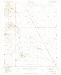
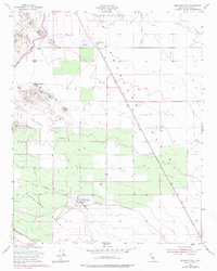
1953 Map of Emigrant Hill
USGS Topo · Published 1974About this map
Hannah Ranch and Yribarren Ranch sit within the arid landscape of western Kern County, where the transition from the Pyramid Hills to the broad Antelope Plain defines the geography. This mid-century survey documents a working landscape focused on livestock and early resource extraction, evident in the cluster of Oil Wells near Mt Vernon. The infrastructure of the era is captured through the presence of the Temblor Pumping Sta and Junction Pumping Sta, which supported the region's industrial and agricultural needs.
Find a feature on this map
22 named features on this map. Tap any name to fly to it.
Don’t see what you’re looking for? This feature index may not catch every label — zoom into the map to look around manually.
Map Details
Editions of this 1953 Emigrant Hill Map
5 editions found
Other maps of this area

1914 · Lost Hills
USGS Topo · 1:125,000

1914 · Cholame
USGS Topo · 1:125,000

1915 · Cholame
USGS Topo · 1:125,000

1917 · Cholame
USGS Topo · 1:125,000

1930 · Avenal Gap
USGS Topo · 1:31,680

1932 · Antelope Plain
USGS Topo · 1:31,680

1932 · West Camp
USGS Topo · 1:31,680

1933 · Avenal Gap
USGS Topo · 1:31,680
1935 · West Camp
USGS Topo · 1:31,680
1936 · Antelope Plain
USGS Topo · 1:31,680