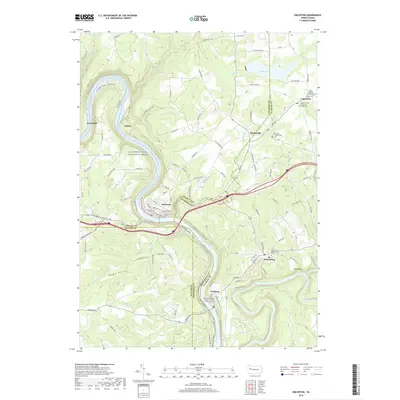
2019 Map of Emlenton
USGS Topo · Published 2019About this map
Allegheny Wild and Scenic River loops sharply through this portion of western Pennsylvania, where the borders of Venango, Clarion, Butler, and Armstrong counties converge. The borough of Emlenton serves as a central hub, situated along a steep bend in the river near the mouth of Richey Run. The landscape is defined by its deep river valleys and high plateaus, which host established settlements like St. Petersburg and Foxburg.
Find a feature on this map
125 named features on this map. Tap any name to fly to it.
Don’t see what you’re looking for? This feature index may not catch every label — zoom into the map to look around manually.
Map Details
Editions of this 2019 Emlenton Map
This is the sole edition of this map. No revisions or reprints were ever made.
Other maps of this area

1907 · Foxburg
USGS Topo · 1:62,500

1908 · Foxburg
USGS Topo · 1:62,500

1909 · Franklin
USGS Topo · 1:62,500

1910 · Hilliards
USGS Topo · 1:62,500

1911 · Franklin
USGS Topo · 1:62,500

1912 · Hilliards
USGS Topo · 1:62,500

1922 · Oil City
USGS Topo · 1:48,000

1924 · Oil City
USGS Topo · 1:62,500

1943 · Oil City
USGS Topo · 1:62,500

1944 · Hilliards
USGS Topo · 1:62,500