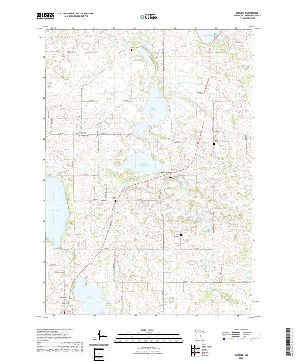
2022 Map of Emmons
USGS Topo · Published 2022About this map
Emmons sits at the very edge of the Minnesota-Iowa border, anchoring a landscape defined by an extensive network of managed water and glacial lakes. This corner of Freeborn County reveals how early 21st-century agricultural land management relies on engineered drainage, with features like Judicial Ditch Number Nine, County Ditch Number Forty, and County Ditch Number Seventeen cutting across the sections to regulate the prairie wetlands. These ditches connect the larger natural bodies of water, including Upper Twin Lake and Lower Twin Lake, which dominate the central terrain.
Find a feature on this map
63 named features on this map. Tap any name to fly to it.
Don’t see what you’re looking for? This feature index may not catch every label — zoom into the map to look around manually.
Map Details
Editions of this 2022 Emmons Map
This is the sole edition of this map. No revisions or reprints were ever made.
Other maps of this area

1954 · Albert Lea
USGS Topo · 1:62,500

1954 · Mason City
USGS Topo · 1:250,000

1955 · Wells
USGS Topo · 1:62,500

1957 · Mason City
USGS Topo · 1:250,000

1958 · Mason City
USGS Topo · 1:250,000

1972 · Fertile NE
USGS Topo · 1:24,000

1972 · Bristol
USGS Topo · 1:24,000
1972 · Lake Mills
USGS Topo · 1:24,000

1982 · Albert Lea West
USGS Topo · 1:24,000
1982 · Emmons
USGS Topo · 1:24,000
Featured Places
- Emmons, MN
- Twin Lakes, MN
- Lakeview Mobile Home Park, Twin Lakes
- Emmons Trailer Court, Emmons
- Freeborn County, MN