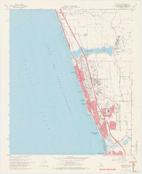
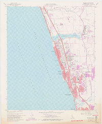
1968 Map of Encinitas
USGS Topo · Published 1969About this map
The coastal communities of San Diego County are captured here during a period of significant post-war expansion. Along the Gulf of Santa Catalina, the residential footprints of Leucadia, Encinitas, and Cardiff-by-the-Sea are shown as they began to densify between the Atchison Topeka and Santa Fe railroad and the recently constructed San Diego Freeway.
Find a feature on this map
57 named features on this map. Tap any name to fly to it.
Don’t see what you’re looking for? This feature index may not catch every label — zoom into the map to look around manually.
Map Details
Editions of this 1968 Encinitas Map
5 editions found
Other maps of this area

1893 · Oceanside
USGS Topo · 1:62,500

1893 · Escondido
USGS Topo · 1:62,500

1898 · Oceanside
USGS Topo · 1:62,500

1901 · Escondido
USGS Topo · 1:62,500

1901 · Oceanside
USGS Topo · 1:62,500

1901 · San Luis Rey
USGS Topo · 1:125,000

1903 · La Jolla
USGS Topo · 1:62,500

1904 · Southern California Sheet No. 2
USGS Topo · 1:250,000

1930 · La Jolla
USGS Topo · 1:62,500
1942 · Oceanside
USGS Topo · 1:62,500