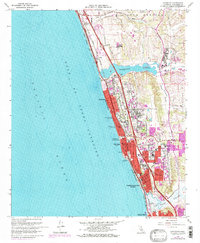
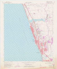
1968 Map of Encinitas
USGS Topo · Published 1978About this map
Batiquitos Lagoon and San Elijo Lagoon punctuate the North County coastline, framing a period of significant suburban expansion along the Gulf of Santa Catalina. The coastal corridor is anchored by the Atchison Topeka and Santa Fe railroad and the San Diego Freeway, which spurred development in communities like Leucadia, Encinitas, and Cardiff-by-the-Sea. Inland, the map captures the transition from the coastal bluffs to the Green Encinitas Valley, where the historic settlement of Olivenhain sits near the eastern edge of the survey. Educational and recreational growth is evident through the presence of the La Costa Country Club, Quail Park Botanical Garden, and the San Dieguito Union High School. The detailed shoreline includes several designated recreation areas, such as Moonlight State Beach and Ponto State Beach, reflecting the region's mid-century evolution into a primary residential and tourism destination.
Find a feature on this map
46 named features on this map. Tap any name to fly to it.
Don’t see what you’re looking for? This feature index may not catch every label — zoom into the map to look around manually.
Map Details
Editions of this 1968 Encinitas Map
5 editions found
Other maps of this area

1893 · Oceanside
USGS Topo · 1:62,500

1893 · Escondido
USGS Topo · 1:62,500

1898 · Oceanside
USGS Topo · 1:62,500

1901 · Escondido
USGS Topo · 1:62,500

1901 · Oceanside
USGS Topo · 1:62,500

1901 · San Luis Rey
USGS Topo · 1:125,000

1903 · La Jolla
USGS Topo · 1:62,500

1904 · Southern California Sheet No. 2
USGS Topo · 1:250,000

1930 · La Jolla
USGS Topo · 1:62,500
1942 · Oceanside
USGS Topo · 1:62,500