
1908 Map of Engineer Mountain
USGS Topo · Published 1908About this map
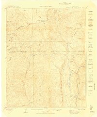
Denver and Rio Grande RR tracks follow the River Animas through the eastern edge of this San Juan Mountains landscape, connecting the high-altitude industrial sites of the era. The map captures a transition in mountain transport and infrastructure, from the Old Tollgate and Butler Trail to the developing power works at Tacoma. In the center of the sheet, the expansive Hermosa Park sits beneath Hermosa Mtn, while Ignacio Reservoir and a nearby Power House indicate the early 20th-century harnessed energy of Cascade Creek. Settlement is sparse, represented by Hamor's Ranch near Columbine Lake, illustrating the isolated nature of ranching and railway life in the high San Juan National Forest before the expansion of modern tourism. Landmark peaks like Engineer Mtn and Jura Knob dominate the northern skyline, marking the rugged divide between San Juan and Dolores counties.
Find a feature on this map
53 named features on this map. Tap any name to fly to it.
Don’t see what you’re looking for? This feature index may not catch every label — zoom into the map to look around manually.
Map Details
Editions of this 1908 Engineer Mountain Map
3 editions found
Other maps of this area

1895 · La Plata
USGS Topo · 1:62,500

1897 · La Plata
USGS Topo · 1:62,500

1897 · Rico
USGS Topo · 1:62,500

1897 · Telluride
USGS Topo · 1:62,500

1897 · Silverton
USGS Topo · 1:62,500

1898 · Durango
USGS Topo · 1:62,500

1898 · Engineer Mountain
USGS Topo · 1:62,500

1898 · Rico
USGS Topo · 1:62,500

1899 · La Plata
USGS Topo · 1:62,500

1899 · Rico
USGS Topo · 1:62,500