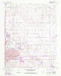
1955 Map of Enid East
USGS Topo · Published 1983About this map
Phillips University and the Oil Refinery anchor the eastern landscape of this mid-century Oklahoma industrial and educational hub. The map illustrates a dense concentration of social and civic infrastructure, from the Enid State Sch to numerous neighborhood institutions like Booker Washington Sch, Garfield Sch, and Roosevelt Sch. Transportation networks are heavily represented by the Atchison Topeka and Santa Fe and Burlington Northern railroads, which facilitated the movement of grain and oil products from the surrounding plains.
Find a feature on this map
51 named features on this map. Tap any name to fly to it.
Don’t see what you’re looking for? This feature index may not catch every label — zoom into the map to look around manually.
Map Details
Editions of this 1955 Enid East Map
4 editions found
Other maps of this area

1955 · Enid West
USGS Topo · 1:24,000

1955 · Enid East
USGS Topo · 1:24,000

1955 · Enid
USGS Topo · 1:250,000

1956 · Garber
USGS Topo · 1:62,500

1956 · Enid
USGS Topo · 1:62,500

1958 · Enid
USGS Topo · 1:250,000

1968 · Hillsdale
USGS Topo · 1:24,000

1968 · Hunter
USGS Topo · 1:24,000

1968 · Kremlin
USGS Topo · 1:24,000
1982 · Waukomis
USGS Topo · 1:24,000