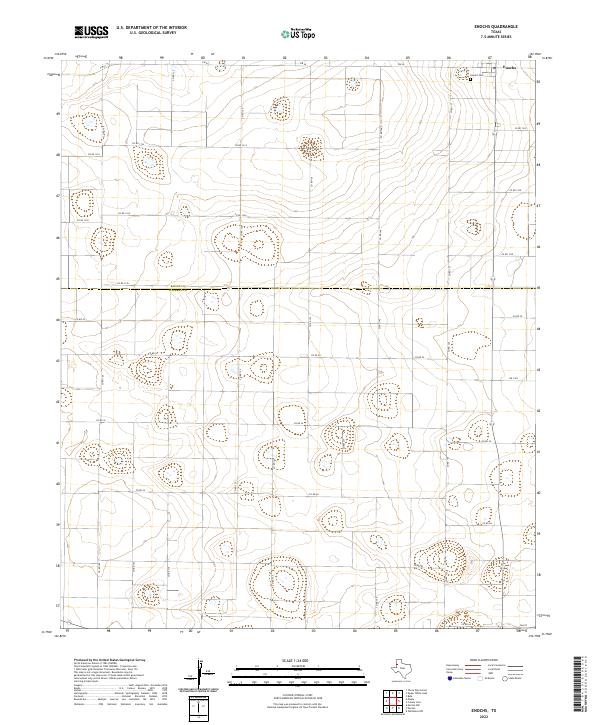
2022 Map of Enochs
USGS Topo · Published 2022About this map
Enochs sits at the far northern edge of this high-plains landscape, where the boundary between Bailey Co and Cochran Co divides the agricultural grid. The area is defined by an extensive network of county roads, such as Co RD 1314 and Co RD 44, which facilitate the movement of goods across this vast expanse of the Llano Estacado. Small depressions and playa lakes are scattered throughout the territory, particularly visible near Co RD 137, illustrating the natural drainage patterns of this semi-arid region. For those researching family history in this corner of the Texas Panhandle, the Enochs Cem serves as a central landmark at the junction of FM 54 and the county line, providing a tangible link to the early settlers of these rural communities.
Find a feature on this map
32 named features on this map. Tap any name to fly to it.
Don’t see what you’re looking for? This feature index may not catch every label — zoom into the map to look around manually.
Map Details
Editions of this 2022 Enochs Map
This is the sole edition of this map. No revisions or reprints were ever made.
Other maps of this area

1954 · Brownfield
USGS Topo · 1:250,000

1958 · Brownfield
USGS Topo · 1:250,000

1962 · Brownfield
USGS Topo · 1:250,000
1968 · Bula
USGS Topo · 1:24,000

1968 · Three Way School
USGS Topo · 1:24,000
1968 · Upper White Lake
USGS Topo · 1:24,000

1969 · Maple
USGS Topo · 1:24,000

1969 · Enochs
USGS Topo · 1:24,000

1970 · Morton NW
USGS Topo · 1:24,000

1971 · Whiteface NW
USGS Topo · 1:24,000