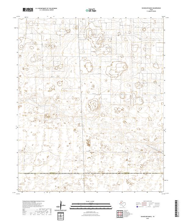
2022 Map of Schooler Ranch
USGS Topo · Published 2022About this map
The Cochran Co and Yoakum Co border defines this portion of the Texas High Plains, where the landscape is etched by the seasonal hydrology of the South Fork Sulphur Draw. This modern U.S. Geological Survey topographic study reveals a geography dominated by large-scale agricultural and ranching divisions, organized by a rigid grid of local routes like FM 1585 and Co Rd 240. The subtle depressions and draws across the terrain reflect the unique drainage patterns of the Llano Estacado. Researchers will find a rural infrastructure focused on connectivity between remote homesteads and ranching hubs, with many dirt and improved roads such as Co Rd 260 and Co Rd 107 providing access to the interior of these expansive county lands.
Find a feature on this map
9 named features on this map. Tap any name to fly to it.
Don’t see what you’re looking for? This feature index may not catch every label — zoom into the map to look around manually.
Map Details
Editions of this 2022 Schooler Ranch Map
This is the sole edition of this map. No revisions or reprints were ever made.
Other maps of this area

1954 · Brownfield
USGS Topo · 1:250,000

1958 · Brownfield
USGS Topo · 1:250,000

1962 · Brownfield
USGS Topo · 1:250,000

1969 · Lehman
USGS Topo · 1:24,000

1970 · Plains 1 SW
USGS Topo · 1:24,000

1970 · Morton SW
USGS Topo · 1:24,000

1970 · Whiteface SW
USGS Topo · 1:24,000

1970 · Plains 1 NW
USGS Topo · 1:24,000

1971 · Schooler Ranch
USGS Topo · 1:24,000
1971 · Two B Ranch
USGS Topo · 1:24,000