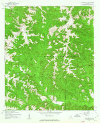
1960 Map of Enterprise NE
USGS Topo · Published 1963About this map
The Fort Rucker U. S. Military Reservation dominates this 1960 landscape, sprawling across the boundary between Coffee and Dale counties. This era of the installation's history is marked by several small airfields and a Lookout Tower, reflecting its role as a primary center for Army aviation training during the early 1960s. Beyond the military boundary, the rural character of the Alabama Wiregrass persists through small church communities like Tabernacle and Old Tabernacle Ch.
Find a feature on this map
18 named features on this map. Tap any name to fly to it.
Don’t see what you’re looking for? This feature index may not catch every label — zoom into the map to look around manually.
Map Details
Editions of this 1960 Enterprise NE Map
2 editions found
Other maps of this area

1942 · Enterprise
USGS Topo · 1:125,000

1948 · Ozark
USGS Topo · 1:62,500

1948 · Brundidge
USGS Topo · 1:62,500

1950 · Ozark
USGS Topo · 1:62,500

1950 · Enterprise
USGS Topo · 1:62,500

1950 · Brundidge
USGS Topo · 1:62,500

1953 · Dothan
USGS Topo · 1:250,000

1954 · Dothan
USGS Topo · 1:250,000

1955 · Dothan
USGS Topo · 1:250,000

1960 · Brundidge SE
USGS Topo · 1:24,000