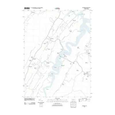
2010 Map of Entriken
USGS Topo · Published 2010About this map
Salmon Hole and the serpentine waters of the Raystown Lake system dominate this central Pennsylvania landscape, where narrow ridges and deep valleys dictate the pattern of settlement. Local history is anchored by the historic Paradise Furnace site along Trough Creek, a reminder of the region's early industrial heritage. The map documents several small, persistent communities such as Entriken, Russellville, and Newburg, alongside a significant concentration of family burial grounds including the Plummer Family Cemetery and Brumbaugh Cemetery.
Find a feature on this map
69 named features on this map. Tap any name to fly to it.
Don’t see what you’re looking for? This feature index may not catch every label — zoom into the map to look around manually.
Map Details
Editions of this 2010 Entriken Map
This is the sole edition of this map. No revisions or reprints were ever made.
Other maps of this area

1900 · Everett
USGS Topo · 1:62,500

1901 · Huntingdon
USGS Topo · 1:62,500

1902 · Everett
USGS Topo · 1:62,500

1902 · Hollidaysburg
USGS Topo · 1:62,500

1903 · Hollidaysburg
USGS Topo · 1:62,500

1904 · Huntingdon
USGS Topo · 1:62,500

1930 · Broad Top
USGS Topo · 1:62,500

1933 · Broad Top
USGS Topo · 1:62,500

1953 · Pittsburgh
USGS Topo · 1:250,000

1954 · Pittsburgh
USGS Topo · 1:250,000