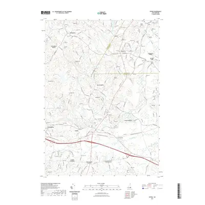
2021 Map of Epping
USGS Topo · Published 2021About this map
The Lamprey River and Piscassic River systems anchor this study of south-central New Hampshire, winding through a landscape defined by small river settlements and an extensive network of family cemeteries. From Nottingham and Nottingham Square in the northwest to Epping and West Epping in the south, the map documents the area's rural character and long-standing genealogical roots. Numerous burial grounds, such as the Josiah D Bartlett Graveyard and the Towle-Edgerly Cem, provide specific points of interest for researchers tracing the early families of Rockingham and Strafford counties. Notable crossings and villages like Wadley Falls and Lyford Crossing illustrate the historical importance of the river power and rail connections that shaped these communities. The presence of the Rockingham Recreational Rail Tr indicates the modern repurposing of former transportation corridors that once linked Brentwood Corners and North Epping to the wider region.
Find a feature on this map
182 named features on this map. Tap any name to fly to it.
Don’t see what you’re looking for? This feature index may not catch every label — zoom into the map to look around manually.
Map Details
Editions of this 2021 Epping Map
This is the sole edition of this map. No revisions or reprints were ever made.
Other maps of this area

1888 · Newburyport
USGS Topo · 1:62,500

1888 · Haverhill
USGS Topo · 1:62,500

1890 · Haverhill
USGS Topo · 1:62,500

1890 · Newburyport
USGS Topo · 1:62,500

1893 · Dover
USGS Topo · 1:62,500

1893 · Haverhill
USGS Topo · 1:62,500

1894 · Newburyport
USGS Topo · 1:62,500

1916 · Dover
USGS Topo · 1:62,500

1917 · Mt. Pawtuckaway
USGS Topo · 1:62,500

1918 · Dover
USGS Topo · 1:62,500