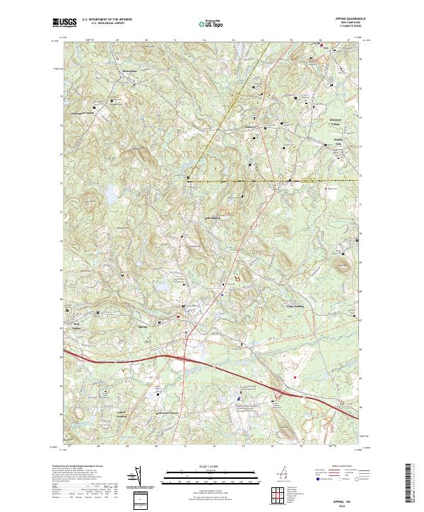
2024 Map of Epping
USGS Topo · Published 2024About this map
Epping and the surrounding Rockingham County landscape are defined by a complex network of colonial-era family burial grounds and historical village centers. This 2024 data showcases how the modern geography respects the early patterns of Nottingham Square and South Lee, where dozen of family-named cemeteries such as the Plumer Family Burial Ground and the Ingalls - Sleeper Cem remain preserved. The Lamprey River, designated here as the Lamprey Wild and Scenic River, winds through the eastern portion of the map, while the Piscassic River flows through the south. Evidence of the region's industrial past is visible in the corridor of the Rockingham Rec. Rail Trl, which follows the old rail line through West Epping and past the Epping Central Cem. These features, alongside the preservation of tracts like Spruce Swamp, highlight a landscape that balances contemporary development with deep-rooted genealogical history.
Find a feature on this map
196 named features on this map. Tap any name to fly to it.
Don’t see what you’re looking for? This feature index may not catch every label — zoom into the map to look around manually.
Map Details
Editions of this 2024 Epping Map
This is the sole edition of this map. No revisions or reprints were ever made.
Other maps of this area

1888 · Newburyport
USGS Topo · 1:62,500

1888 · Haverhill
USGS Topo · 1:62,500

1890 · Haverhill
USGS Topo · 1:62,500

1890 · Newburyport
USGS Topo · 1:62,500

1893 · Dover
USGS Topo · 1:62,500

1893 · Haverhill
USGS Topo · 1:62,500

1894 · Newburyport
USGS Topo · 1:62,500

1916 · Dover
USGS Topo · 1:62,500

1917 · Mt. Pawtuckaway
USGS Topo · 1:62,500

1918 · Dover
USGS Topo · 1:62,500