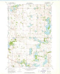
1973 Map of Erdahl
USGS Topo · Published 1975About this map
The unincorporated community of Erdahl serves as a focal point in this 1970s landscape of the West Central Minnesota lake country. Located along the Soo Line railroad, the area is defined by a dense concentration of glacial kettles and wetlands, including Thompson Lake, Peterson Lake, and Torstenson Lake. The map reveals a rural social infrastructure through landmarks like the Townhall and several local burial grounds, including Zionaborg Cem, Lincoln Cem, and the Barrett Covenant Cem near the Barrett corporate boundary. Broad conservation efforts are evident in the numerous designated areas such as the National Waterfowl Production Area and the Anderson State Wildlife Management Area. An Old Railroad Grade north of Erdahl indicates the shifting transportation routes of the mid-20th century as the local rail economy evolved.
Find a feature on this map
46 named features on this map. Tap any name to fly to it.
Don’t see what you’re looking for? This feature index may not catch every label — zoom into the map to look around manually.
Map Details
Editions of this 1973 Erdahl Map
This is the sole edition of this map. No revisions or reprints were ever made.
Other maps of this area

1911 · Barrett
USGS Topo · 1:62,500

1913 · Ashby
USGS Topo · 1:62,500

1953 · Brainerd
USGS Topo · 1:250,000

1953 · Saint Cloud
USGS Topo · 1:250,000

1957 · Brainerd
USGS Topo · 1:250,000

1957 · Saint Cloud
USGS Topo · 1:250,000

1958 · Saint Cloud
USGS Topo · 1:250,000

1958 · Brainerd
USGS Topo · 1:250,000

1965 · Brainerd
USGS Topo · 1:250,000

1966 · Kensington
USGS Topo · 1:24,000