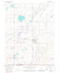
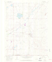
1967 Map of Erie
USGS Topo · Published 1980About this map
Erie and Lafayette anchor this 1960s study of the northern Colorado plains, a landscape transitioning from a coal-mining economy to suburban growth. The presence of the Erie Mine and Columbine Mine along the Burlington Northern and Union Pacific tracks highlights the region's industrial foundations. Water management is central to the area's layout, with an extensive network of ditches like the Boulder and Whiterock Ditch feeding reservoirs such as Panama Res No 1, Prince Lake No 1, and Thomas Reservoir. These features supported the agricultural development around smaller settlements like Canfield, Tabor, and Leyner. The map also documents mid-century recreational and infrastructure changes, including the Mountain View Drag Strip and the Tri-County Airport near the Weld and Adams county line.
Find a feature on this map
51 named features on this map. Tap any name to fly to it.
Don’t see what you’re looking for? This feature index may not catch every label — zoom into the map to look around manually.
Map Details
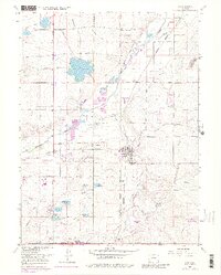
Editions of this 1967 Erie Map
6 editions found
Other maps of this area

1890 · East Denver
USGS Topo · 1:125,000

1899 · West Denver
USGS Topo · 1:125,000

1902 · Greeley
USGS Topo · 1:125,000

1904 · Niwot
USGS Topo · 1:62,500

1940 · Eastlake
USGS Topo · 1:31,680

1940 · Lafayette
USGS Topo · 1:31,680

1942 · Louisville
USGS Topo · 1:31,680

1944 · Lafayette
USGS Topo · 1:31,680

1944 · Eastlake
USGS Topo · 1:31,680

1949 · Gowanda
USGS Topo · 1:24,000