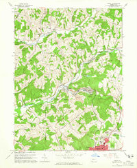
1963 Map of Ernest
USGS Topo · Published 1965About this map
The industrial and rural character of western Pennsylvania is defined here by the Baltimore and Ohio railroad corridor as it follows the winding path of Crooked Creek. This early 1960s landscape is a complex of extractive industry and established local communities, where numerous gas wells and coal features like Mina Dump sit adjacent to family-named landmarks such as Kunkle Hill and Coleman Hill. The map documents the northern expansion of Indiana toward residential developments like Chevy Chase Heights and Bryan Hill Manor, while the presence of the Lions Health Camp and Chestnut Grove Golf Course suggests a transition toward mid-century recreation. Genealogists will find significant value in the distribution of rural burial grounds, including Old Washington Cem and Plum Creek Ch Cem, and the community anchors of Harmony Grove Ch and Washington Ch which served the surrounding farming and mining families.
Find a feature on this map
66 named features on this map. Tap any name to fly to it.
Don’t see what you’re looking for? This feature index may not catch every label — zoom into the map to look around manually.
Map Details
Editions of this 1963 Ernest Map
4 editions found
Other maps of this area

1901 · Rural Valley
USGS Topo · 1:62,500

1902 · Indiana
USGS Topo · 1:62,500

1902 · Elders Ridge
USGS Topo · 1:62,500

1903 · Rural Valley
USGS Topo · 1:62,500

1904 · Elders Ridge
USGS Topo · 1:62,500

1909 · Smicksburg
USGS Topo · 1:62,500

1938 · Smicksburg
USGS Topo · 1:62,500

1939 · Smicksburg
USGS Topo · 1:62,500

1953 · Pittsburgh
USGS Topo · 1:250,000

1954 · Pittsburgh
USGS Topo · 1:250,000