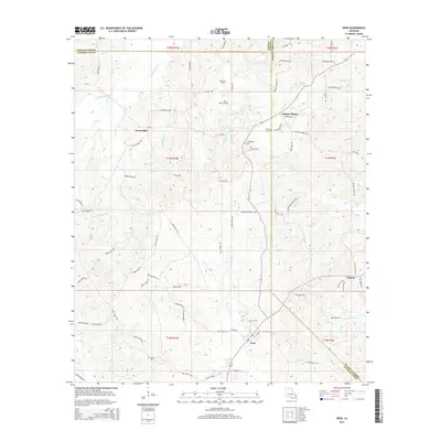
2015 Map of Eros
USGS Topo · Published 2015About this map
Eros serves as a central hub in this section of Jackson Parish, positioned at the convergence of local routes near the Eros Cem. The landscape is defined by the winding paths of S Choudrant Cr and Flat Cr, which drain the surrounding timberlands and agricultural plots. This map documents a region where community life historically centered on small settlements and family burying grounds, evidenced by the numerous cemeteries including Old Zeigler Cem and Butler Cem found near established roads.
Find a feature on this map
98 named features on this map. Tap any name to fly to it.
Don’t see what you’re looking for? This feature index may not catch every label — zoom into the map to look around manually.
Map Details
Editions of this 2015 Eros Map
This is the sole edition of this map. No revisions or reprints were ever made.
Other maps of this area

1950 · Ruston
USGS Topo · 1:62,500

1951 · Ruston
USGS Topo · 1:62,500

1952 · Calhoun
USGS Topo · 1:62,500

1953 · Chatham
USGS Topo · 1:62,500

1953 · Hodge
USGS Topo · 1:62,500

1955 · Shreveport
USGS Topo · 1:250,000

1956 · Shreveport
USGS Topo · 1:250,000

1982 · Chatham
USGS Topo · 1:24,000
1982 · Calhoun
USGS Topo · 1:24,000

1982 · Chatham SE
USGS Topo · 1:24,000