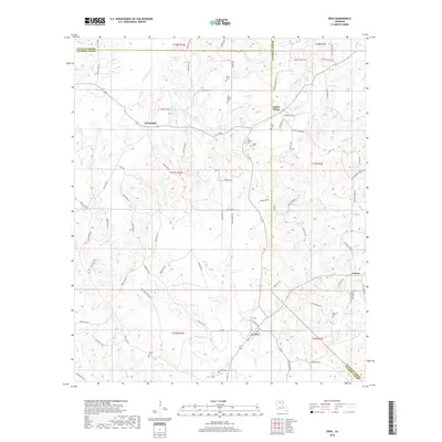
2018 Map of Eros
USGS Topo · Published 2018About this map
Eros serves as a focal point for this landscape near the junction of Jackson and Ouachita Parishes, characterized by a dense network of creeks and small settlements. The topography is defined by numerous drainage systems, including Flat Cr and Clear Cr, which carve through the timbered terrain. Small rural communities like Indian Village and Cartwright are connected by a web of local routes such as Alton Mills Rd and Guyton Swamp Rd. Genealogists will find a significant number of family-named burial sites across the township, from the Old Zeigler Cem and Butler Cem in the north to the Williams Cem near Guyton in the southeast. These cemeteries, alongside landmarks like Mills Pond, provide a clear picture of the established family networks that have long occupied these parish lines.
Find a feature on this map
74 named features on this map. Tap any name to fly to it.
Don’t see what you’re looking for? This feature index may not catch every label — zoom into the map to look around manually.
Map Details
Editions of this 2018 Eros Map
This is the sole edition of this map. No revisions or reprints were ever made.
Other maps of this area

1950 · Ruston
USGS Topo · 1:62,500

1951 · Ruston
USGS Topo · 1:62,500

1952 · Calhoun
USGS Topo · 1:62,500

1953 · Chatham
USGS Topo · 1:62,500

1953 · Hodge
USGS Topo · 1:62,500

1955 · Shreveport
USGS Topo · 1:250,000

1956 · Shreveport
USGS Topo · 1:250,000

1982 · Chatham
USGS Topo · 1:24,000
1982 · Calhoun
USGS Topo · 1:24,000

1982 · Chatham SE
USGS Topo · 1:24,000