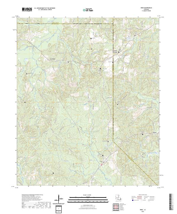
2024 Map of Eros
USGS Topo · Published 2024About this map
The town of Eros and the small crossroads of Cartwright and Indian Village anchor this survey of the hill country where Jackson, Lincoln, and Ouachita Parishes meet. The landscape is defined by a dense network of creek branches and family burial grounds, suggesting a long-established pattern of small-holding agriculture and kinship-based settlement. Significant watercourses like Sandy Creek and South Choudrant Creek drain the northern reaches, while the southern terrain is crisscrossed by smaller named flows such as Taylor Branch and Collie Branch.
Find a feature on this map
106 named features on this map. Tap any name to fly to it.
Don’t see what you’re looking for? This feature index may not catch every label — zoom into the map to look around manually.
Map Details
Editions of this 2024 Eros Map
This is the sole edition of this map. No revisions or reprints were ever made.
Other maps of this area

1950 · Ruston
USGS Topo · 1:62,500

1951 · Ruston
USGS Topo · 1:62,500

1952 · Calhoun
USGS Topo · 1:62,500

1953 · Chatham
USGS Topo · 1:62,500

1953 · Hodge
USGS Topo · 1:62,500

1955 · Shreveport
USGS Topo · 1:250,000

1956 · Shreveport
USGS Topo · 1:250,000

1982 · Chatham
USGS Topo · 1:24,000
1982 · Calhoun
USGS Topo · 1:24,000

1982 · Chatham SE
USGS Topo · 1:24,000