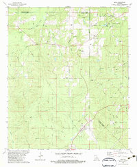
1982 Map of Eros
USGS Topo · Published 1983About this map
The town of Eros anchors the southern portion of this landscape, situated at the intersection of a state highway and an Old Grade roadbed. This early 1980s topography reveals a rural landscape defined by parish boundaries, where Jackson Parish, Lincoln Parish, and Ouachita Parish converge. The area is heavily influenced by the extraction industry, marked by the extensive Calhoun Gas and Oil Field and Cheniere Gas Field, alongside numerous pipelines and active gas wells.
Find a feature on this map
61 named features on this map. Tap any name to fly to it.
Don’t see what you’re looking for? This feature index may not catch every label — zoom into the map to look around manually.
Map Details
Editions of this 1982 Eros Map
This is the sole edition of this map. No revisions or reprints were ever made.
Other maps of this area

1950 · Ruston
USGS Topo · 1:62,500

1951 · Ruston
USGS Topo · 1:62,500

1952 · Calhoun
USGS Topo · 1:62,500

1953 · Chatham
USGS Topo · 1:62,500

1953 · Hodge
USGS Topo · 1:62,500

1955 · Shreveport
USGS Topo · 1:250,000

1956 · Shreveport
USGS Topo · 1:250,000

1982 · Chatham
USGS Topo · 1:24,000
1982 · Calhoun
USGS Topo · 1:24,000

1982 · Chatham SE
USGS Topo · 1:24,000