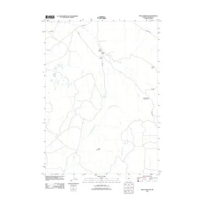
2012 Map of Ervay Basin SW
USGS Topo · Published 2012About this map
Black Mountain anchors the southern portion of this high-plains landscape in Natrona County, where the drainages of Middle Fork Sage Hen Cr and E Fork Sage Hen Cr converge near Boyle Reservoir. The region is defined by remote homesteading and ranching infrastructure, such as the Holiday Homestead and the Strawhaker Corral. Water sources like McKenzie Spring and Little Cross L Spring provide critical points of interest in a dry environment dominated by topographic landmarks like the Deer Creek- Dry Creek Divide and the French Rocks. The northern reach of the map shows early 21st-century access via Gas Hills Rd and the Gas Hills Airstrip, highlighting the area's continued use for specialized transportation and livestock operations.
Find a feature on this map
23 named features on this map. Tap any name to fly to it.
Don’t see what you’re looking for? This feature index may not catch every label — zoom into the map to look around manually.
Map Details
Editions of this 2012 Ervay Basin SW Map
This is the sole edition of this map. No revisions or reprints were ever made.
Other maps of this area

1952 · Ervay Basin SW
USGS Topo · 1:24,000

1952 · Gas Hills
USGS Topo · 1:24,000

1952 · Miles Ranch
USGS Topo · 1:24,000

1952 · Ervay Basin
USGS Topo · 1:24,000

1952 · Mc Intosh Meadows
USGS Topo · 1:24,000

1955 · Casper
USGS Topo · 1:250,000

1957 · Miles Ranch
USGS Topo · 1:24,000

1958 · Casper
USGS Topo · 1:250,000
1958 · Gas Hills
USGS Topo · 1:24,000
1959 · Mc Rae Gap
USGS Topo · 1:24,000