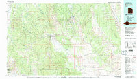
1980 Map of Escalante
USGS Topo · Published 1988About this map
The Escalante River corridor dominates this high-plateau landscape, showing the transition from the forested peaks of the Dixie National Forest down into the labyrinthine canyons of the Glen Canyon National Recreation Area. By 1980, the town of Escalante serves as a central hub for the region, with the nearby Escalante Airport and Utah 12 providing the primary access through the Upper Valley. The map details the massive geological barriers of the Straight Cliffs and the Kaiparowits Plateau, which long isolated these remote settlements.
Find a feature on this map
109 named features on this map. Tap any name to fly to it.
Don’t see what you’re looking for? This feature index may not catch every label — zoom into the map to look around manually.
Map Details
Editions of this 1980 Escalante Map
3 editions found
Other maps of this area

1885 · San Rafael
USGS Topo · 1:250,000

1885 · Beaver
USGS Topo · 1:250,000

1885 · Fish Lake
USGS Topo · 1:250,000

1886 · Kanab
USGS Topo · 1:250,000

1886 · Escalante
USGS Topo · 1:250,000

1886 · Henry Mountains
USGS Topo · 1:250,000

1892 · Henry Mountains
USGS Topo · 1:250,000

1896 · Fish Lake
USGS Topo · 1:250,000

1922 · Upper Last Chance
USGS Topo · 1:63,360

1922 · Rees Canyon
USGS Topo · 1:63,360