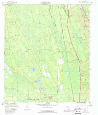
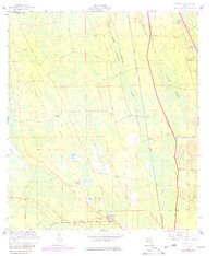
1957 Map of Espanola
USGS Topo · Published 1988About this map
Espanola and the nearby settlement of Neoga anchor this coastal Florida landscape, where development is defined by the drainage of low-lying wetlands. The map reveals an intricate network of waterways and infrastructure projects, including the Intracoastal Waterway and the St Joe Canal, which carve through the dense terrain of Pringle Swamp and Hulett Swamp. Local life centers around features like St Pauls Ch and the town Athletic Field, while the Railroad and the Old Brick Road represent the primary transportation corridors of the mid-20th century.
Find a feature on this map
19 named features on this map. Tap any name to fly to it.
Don’t see what you’re looking for? This feature index may not catch every label — zoom into the map to look around manually.
Map Details
Editions of this 1957 Espanola Map
5 editions found
Other maps of this area

1927 · Matanzas
USGS Topo · 1:48,000

1937 · Dinner Island
USGS Topo · 1:48,000

1937 · Ormond
USGS Topo · 1:48,000

1943 · Dinner Island
USGS Topo · 1:62,500

1943 · Matanzas
USGS Topo · 1:62,500

1944 · Ormond
USGS Topo · 1:62,500

1944 · Dinner Island
USGS Topo · 1:62,500

1944 · Matanzas
USGS Topo · 1:62,500

1954 · Daytona Beach
USGS Topo · 1:250,000

1956 · Dinner Island NE
USGS Topo · 1:24,000