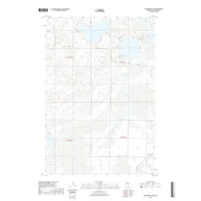
2019 Map of Esquagamah Lake
USGS Topo · Published 2019About this map
Esquagamah Lake dominates the northern landscape of this Aitkin County survey, surrounded by a cluster of smaller water bodies including Round Lake, Avenue Lake, and Waukenabo Lake. This region of Minnesota is defined by its dense wetland systems and complex hydrology, with the Little Willow River winding through the central terrain toward the south. The Mississippi River clips the southeastern corner of the quadrangle, where the Great River Rd follows its banks near the Riverside Cem. The 2019 data shows a network of rural roads such as Lake Esquagamah RD and Osprey Ave that provide access to the various shorelines. Isolated features like Blind Lake and Kritwitz Lake are located within vast marshy sections, illustrating the remote and water-saturated character of the Aitkin County wilderness in the early twenty-first century.
Find a feature on this map
42 named features on this map. Tap any name to fly to it.
Don’t see what you’re looking for? This feature index may not catch every label — zoom into the map to look around manually.
Map Details
Editions of this 2019 Esquagamah Lake Map
This is the sole edition of this map. No revisions or reprints were ever made.
Other maps of this area

1913 · Cuyuna
USGS Topo · 1:62,500

1914 · Aitkin
USGS Topo · 1:62,500

1915 · Aitkin
USGS Topo · 1:62,500

1915 · Cuyuna
USGS Topo · 1:62,500

1953 · Duluth
USGS Topo · 1:250,000

1958 · Duluth
USGS Topo · 1:250,000

1970 · Edna Lake
USGS Topo · 1:24,000

1970 · Bain
USGS Topo · 1:24,000

1970 · White Elk Lake
USGS Topo · 1:24,000

1973 · Iron Hub
USGS Topo · 1:24,000