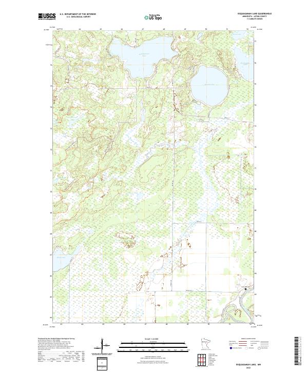
2022 Map of Esquagamah Lake
USGS Topo · Published 2022About this map
Esquagamah Lake and the complex wetlands of Aitkin County define this landscape, where the waters of the Little Willow River meander toward the Mississippi River in the southeast corner. The terrain is characterized by a high density of glacial lakes and marshy basins, including Round Lake, Waukenabo Lake, and Krilwitz Lake. This region of Minnesota shows a pattern of seasonal and residential development along the shorelines, connected by local routes like Lake Esquagamah Rd and Osprey Ave. Genealogists and local historians will find the Riverside Cem situated near the riverbanks, providing a specific point of interest for family research. The extensive trail network, featuring the Blind Lake Trl and its various connectors, suggests a landscape managed for both conservation and recreation within the timbered lake country of the Upper Mississippi basin.
Find a feature on this map
45 named features on this map. Tap any name to fly to it.
Don’t see what you’re looking for? This feature index may not catch every label — zoom into the map to look around manually.
Map Details
Editions of this 2022 Esquagamah Lake Map
This is the sole edition of this map. No revisions or reprints were ever made.
Other maps of this area

1913 · Cuyuna
USGS Topo · 1:62,500

1914 · Aitkin
USGS Topo · 1:62,500

1915 · Aitkin
USGS Topo · 1:62,500

1915 · Cuyuna
USGS Topo · 1:62,500

1953 · Duluth
USGS Topo · 1:250,000

1958 · Duluth
USGS Topo · 1:250,000

1970 · Edna Lake
USGS Topo · 1:24,000

1970 · Bain
USGS Topo · 1:24,000

1970 · White Elk Lake
USGS Topo · 1:24,000

1973 · Iron Hub
USGS Topo · 1:24,000