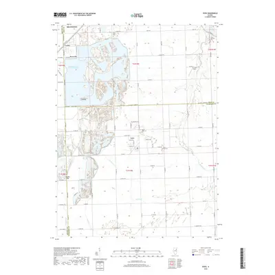
2018 Map of Essex
USGS Topo · Published 2018About this map
Braidwood and the smaller settlements of Godley, Braceville, and Essex anchor a landscape defined by industrial development and the convergence of Grundy, Will, and Kankakee counties. The vast Braidwood Power Plant Cooling Pond dominates the northwestern quadrant, its complex shoreline reflecting modern engineering alongside older village footprints. In the eastern reaches, the terrain is more agricultural, drained by Horse Creek and its tributaries, where the Corn Field Airport and several historic burial grounds, including Mount Olivet Cem and Custer Township Cem, provide local landmarks. The grid-like road system, featuring routes like W Smiley Rd and Co Line Rd W 6000 N RD, connects these scattered rural communities. This map details a specific intersection of infrastructure and Illinois prairie history, capturing the transition from coal-era villages like Clarke City and Torino to a landscape centered on power generation.
Find a feature on this map
51 named features on this map. Tap any name to fly to it.
Don’t see what you’re looking for? This feature index may not catch every label — zoom into the map to look around manually.
Map Details
Editions of this 2018 Essex Map
This is the sole edition of this map. No revisions or reprints were ever made.
Other maps of this area

1892 · Morris
USGS Topo · 1:62,500

1892 · Wilmington
USGS Topo · 1:62,500

1918 · Wilmington
USGS Topo · 1:62,500

1918 · Morris
USGS Topo · 1:62,500

1923 · Herscher
USGS Topo · 1:62,500

1925 · Herscher
USGS Topo · 1:62,500

1948 · Dwight
USGS Topo · 1:62,500

1950 · Dwight
USGS Topo · 1:62,500

1953 · Coal City
USGS Topo · 1:24,000

1953 · Symerton
USGS Topo · 1:24,000