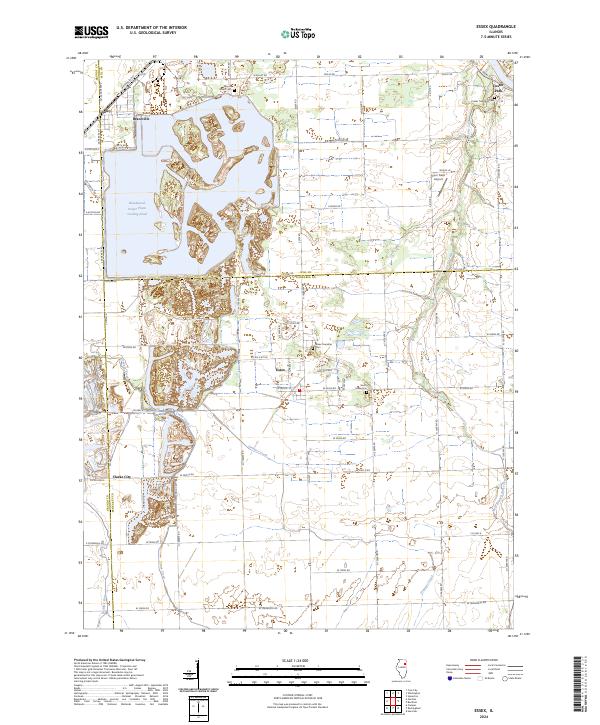
2024 Map of Essex
USGS Topo · Published 2024About this map
Essex stands at the center of this Kankakee County landscape, surrounded by a transition from industrial utility to rural prairie. The northern portion of the map is dominated by the expansive Braidwood Power Plant Cooling Pond, a massive water feature that has reshaped the local topography and borders the communities of Godley and Braceville. Historically significant sites like Clarke City and the South Essex Cem reflect the long-standing settlement patterns of the region.
Find a feature on this map
45 named features on this map. Tap any name to fly to it.
Don’t see what you’re looking for? This feature index may not catch every label — zoom into the map to look around manually.
Map Details
Editions of this 2024 Essex Map
This is the sole edition of this map. No revisions or reprints were ever made.
Other maps of this area

1892 · Morris
USGS Topo · 1:62,500

1892 · Wilmington
USGS Topo · 1:62,500

1918 · Wilmington
USGS Topo · 1:62,500

1918 · Morris
USGS Topo · 1:62,500

1923 · Herscher
USGS Topo · 1:62,500

1925 · Herscher
USGS Topo · 1:62,500

1948 · Dwight
USGS Topo · 1:62,500

1950 · Dwight
USGS Topo · 1:62,500

1953 · Coal City
USGS Topo · 1:24,000

1953 · Symerton
USGS Topo · 1:24,000