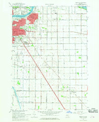
1967 Map of Essexville
USGS Topo · Published 1968About this map
The Saginaw River flows into the southern reaches of Saginaw Bay, anchoring an industrial and agricultural landscape in the late 1960s. The city of Essexville and eastern Bay City dominate the northwest corner of the map, where heavy infrastructure like the Sewage Disposal plant and the County Fairground sit alongside dense residential blocks and parochial institutions like St John Sch. To the east and south, the land transitions into a highly managed drainage network where numerous named channels, including the Walther Drain and Hugo Drain, supported the productive farm fields of Hampton and Portsmouth townships.
Find a feature on this map
64 named features on this map. Tap any name to fly to it.
Don’t see what you’re looking for? This feature index may not catch every label — zoom into the map to look around manually.
Map Details
Editions of this 1967 Essexville Map
3 editions found
Other maps of this area

1916 · Bay City
USGS Topo · 1:62,500

1919 · Bay City
USGS Topo · 1:62,500

1919 · Saginaw
USGS Topo · 1:62,500

1941 · Saginaw
USGS Topo · 1:62,500

1943 · Bay City
USGS Topo · 1:62,500

1943 · Saginaw
USGS Topo · 1:62,500

1954 · Flint
USGS Topo · 1:250,000

1958 · Flint
USGS Topo · 1:250,000

1963 · Quanicassee
USGS Topo · 1:24,000

1963 · Reese
USGS Topo · 1:24,000