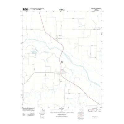
2012 Map of Estelline
USGS Topo · Published 2012About this map
The Prairie Dog Town Fork Red River bisects this Hall County landscape, where the settlement of Estelline serves as a local hub near the Estelline Salt Springs. The map reveals a rural infrastructure defined by a grid of county roads and ranch-to-market routes that connect small communities like Newlin and Plains Junction. Genealogists will find the locations of the Newlin Cem and Estelline Cem clearly marked, providing spatial context for family histories in the eastern Texas Panhandle. Several waterways, including Mountain Cr, Rustlers Cr, and Jonah Cr, cut through the terrain, illustrating the drainage patterns that have shaped the area's ranching and agricultural development over decades.
Find a feature on this map
35 named features on this map. Tap any name to fly to it.
Don’t see what you’re looking for? This feature index may not catch every label — zoom into the map to look around manually.
Map Details
Editions of this 2012 Estelline Map
This is the sole edition of this map. No revisions or reprints were ever made.
Other maps of this area

1954 · Plainview
USGS Topo · 1:250,000

1958 · Plainview
USGS Topo · 1:250,000

1961 · Memphis
USGS Topo · 1:62,500

1961 · Estelline
USGS Topo · 1:62,500

1967 · Tell North
USGS Topo · 1:24,000

1967 · Badger Nest Tank
USGS Topo · 1:24,000

1967 · Carey
USGS Topo · 1:24,000

1976 · Memphis SE
USGS Topo · 1:24,000

1976 · Memphis NE
USGS Topo · 1:24,000

1984 · Estelline NE
USGS Topo · 1:24,000