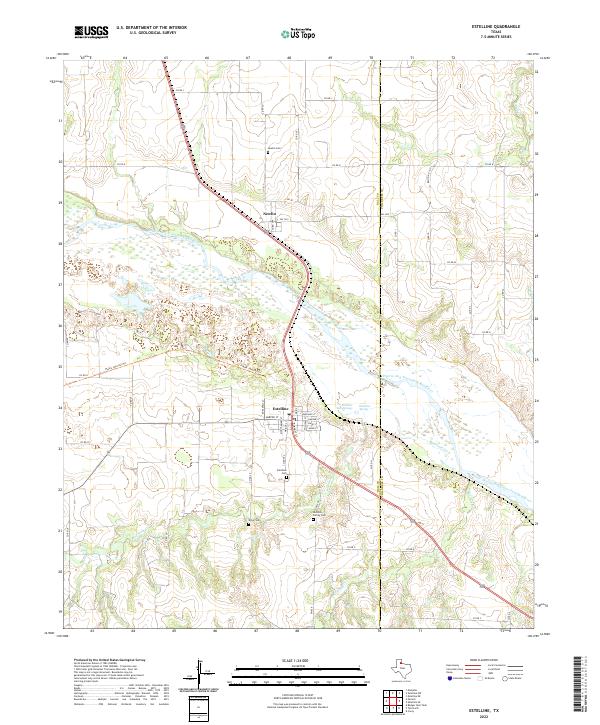
2022 Map of Estelline
USGS Topo · Published 2022About this map
The Prairie Dog Town Fork Red River carves a broad, braided path across this landscape, defining the boundary between the northern plains and the town of Estelline. This area is marked by a deep genealogical footprint, with several family and community burial grounds including the Hutchins Family Cem, Dillon Cem, and the municipal Estelline Cem. To the north, the small settlement of Newlin sits near the river's edge, served by its own Newlin Cem. The terrain is characterized by the presence of significant hydrologic features like the Estelline Salt Springs and Estelline Spring, which feed into the main river system alongside smaller tributaries like Mountain Cr and Rustlers Cr. The map captures the organized street grid of Estelline, where local life centered around thoroughfares like Main St and Roosevelt St.
Find a feature on this map
46 named features on this map. Tap any name to fly to it.
Don’t see what you’re looking for? This feature index may not catch every label — zoom into the map to look around manually.
Map Details
Editions of this 2022 Estelline Map
This is the sole edition of this map. No revisions or reprints were ever made.
Other maps of this area

1954 · Plainview
USGS Topo · 1:250,000

1958 · Plainview
USGS Topo · 1:250,000

1961 · Memphis
USGS Topo · 1:62,500

1961 · Estelline
USGS Topo · 1:62,500

1967 · Tell North
USGS Topo · 1:24,000

1967 · Badger Nest Tank
USGS Topo · 1:24,000

1967 · Carey
USGS Topo · 1:24,000

1976 · Memphis SE
USGS Topo · 1:24,000

1976 · Memphis NE
USGS Topo · 1:24,000

1984 · Estelline NE
USGS Topo · 1:24,000