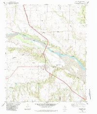
1985 Map of Estelline
USGS Topo · Published 1985About this map
Newlin and Estelline anchor this mid-1980s look at the Texas Panhandle, situated where the Burlington Northern railroad corridors parallel the wide, braided course of the Prairie Dog Town Fork Red River. The landscape is defined by the sharp transition between the flat upland plains and the dissected drainage basins of Mountain Creek and Rustlers Creek. Local history is preserved in the location of the Newlin Cem and an additional Cem south of Estelline, while the presence of Estelline Spring (Salt) and a widespread network of wells indicates the region's reliance on groundwater management. The map also records the boundary line between Hall and Childress counties, tracing the administrative and physical geography of this cattle and agricultural corridor during a period of established rural infrastructure.
Find a feature on this map
18 named features on this map. Tap any name to fly to it.
Don’t see what you’re looking for? This feature index may not catch every label — zoom into the map to look around manually.
Map Details
Editions of this 1985 Estelline Map
This is the sole edition of this map. No revisions or reprints were ever made.
Other maps of this area

1954 · Plainview
USGS Topo · 1:250,000

1958 · Plainview
USGS Topo · 1:250,000

1961 · Memphis
USGS Topo · 1:62,500

1961 · Estelline
USGS Topo · 1:62,500

1967 · Tell North
USGS Topo · 1:24,000

1967 · Badger Nest Tank
USGS Topo · 1:24,000

1967 · Carey
USGS Topo · 1:24,000

1976 · Memphis SE
USGS Topo · 1:24,000

1976 · Memphis NE
USGS Topo · 1:24,000

1984 · Estelline NE
USGS Topo · 1:24,000