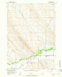
1959 Map of Ethete
USGS Topo · Published 1961About this map
Ethete and its surroundings on the Wind River Reservation reveal a landscape deeply shaped by community institutions and water management in the late 1950s. The settlement is anchored by the mission, St James Ch, and the Wind River Day School, while the outlying areas are dotted with family and community burial grounds such as White Plume Cem, Wallowing Bull Cem, and Red Man Cem. The terrain is dominated by the prominent Bighorn Ridge to the west, with the Wind River and Little Wind River providing the lifeblood for the valley's agricultural infrastructure.
Find a feature on this map
31 named features on this map. Tap any name to fly to it.
Don’t see what you’re looking for? This feature index may not catch every label — zoom into the map to look around manually.
Map Details
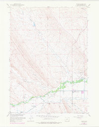
Editions of this 1959 Ethete Map
2 editions found
Other maps of this area

1950 · Pavillion
USGS Topo · 1:24,000

1951 · Mule Butte
USGS Topo · 1:24,000

1951 · Morton
USGS Topo · 1:24,000

1951 · Fort Washakie
USGS Topo · 1:24,000

1951 · Argo Butte
USGS Topo · 1:24,000

1951 · Ethete
USGS Topo · 1:24,000

1952 · Ray Lake
USGS Topo · 1:24,000

1952 · Wind River
USGS Topo · 1:24,000

1952 · Lander NW
USGS Topo · 1:24,000

1955 · Thermopolis
USGS Topo · 1:250,000