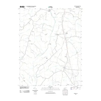
2010 Map of Eubank
USGS Topo · Published 2010About this map
Eubank and Waynesburg anchor this rural landscape in Pulaski County at the start of the 2010s, where small settlements are connected by a network of ridge-top roads and creek-valley crossings. The area is notable for its high density of family and community burial grounds, including the Double Spring Cemetery and Falconbury Cemetery, which provide essential touchstones for local genealogical research.
Find a feature on this map
79 named features on this map. Tap any name to fly to it.
Don’t see what you’re looking for? This feature index may not catch every label — zoom into the map to look around manually.
Map Details
Editions of this 2010 Eubank Map
This is the sole edition of this map. No revisions or reprints were ever made.
Other maps of this area

1935 · Somerset
USGS Topo · 1:62,500

1952 · Halls Gap
USGS Topo · 1:24,000

1952 · Eubank
USGS Topo · 1:24,000

1952 · Crab Orchard
USGS Topo · 1:24,000

1952 · Hustonville
USGS Topo · 1:24,000

1952 · Yosemite
USGS Topo · 1:24,000

1952 · Woodstock
USGS Topo · 1:24,000

1953 · Mintonville
USGS Topo · 1:24,000
1954 · Bobtown
USGS Topo · 1:24,000

1954 · Science Hill
USGS Topo · 1:24,000