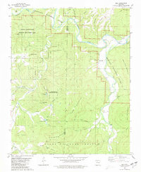
1980 Map of Eula
USGS Topo · Published 1981About this map
The Buffalo National River carves a winding path across this 1980 survey, defining the rugged geography of the Newton and Searcy County border. This is a landscape of high benches and deep hollows, where small settlements like Woolum and Eula sit near the river's edge, and Bass occupies the southwest corner. The map documents a scattered rural social fabric, marked by family-named cemeteries such as Hendrix Cem, Dodson Cem, and Cash Cem, along with the Bens Branch Ch. High points like Point Peter Mountain and Horn Mountain tower over the valley floors. The presence of the Buffalo River State Wildlife Management Area and the Ozark National Forest reflects the transition of this area into protected public lands during the late twentieth century, while a remote Landing Strip and Picnic Area near Hurricane Lake hint at early recreational development.
Find a feature on this map
56 named features on this map. Tap any name to fly to it.
Don’t see what you’re looking for? This feature index may not catch every label — zoom into the map to look around manually.
Map Details
Editions of this 1980 Eula Map
2 editions found
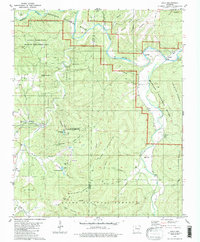
Other maps of this area

1892 · Marshall
USGS Topo · 1:125,000

1893 · Yellville
USGS Topo · 1:125,000

1894 · Marshall
USGS Topo · 1:125,000

1901 · Marshall
USGS Topo · 1:125,000

1903 · Yellville
USGS Topo · 1:125,000

1904 · Harrison
USGS Topo · 1:125,000

1905 · Harrison
USGS Topo · 1:125,000

1905 · Yellville
USGS Topo · 1:125,000

1929 · Yellville
USGS Topo · 1:125,000

1933 · Mt Judea
USGS Topo · 1:62,500