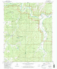
1980 Map of Eula
USGS Topo · Published 1986About this map
The Buffalo National River carves a deep path through the Ozarks here, forming the centerpiece of a landscape defined by sharp elevation changes and numerous river crossings. In the mid-1970s, the area retained its character as a region of small, isolated settlements like Eula, Bass, and Cave Creek. River access was critical for local travel, as evidenced by several named crossings such as Woolum Ford and Roughedge Ford along the main channel.
Find a feature on this map
57 named features on this map. Tap any name to fly to it.
Don’t see what you’re looking for? This feature index may not catch every label — zoom into the map to look around manually.
Map Details
Editions of this 1980 Eula Map
2 editions found
Other maps of this area

1892 · Marshall
USGS Topo · 1:125,000

1893 · Yellville
USGS Topo · 1:125,000

1894 · Marshall
USGS Topo · 1:125,000

1901 · Marshall
USGS Topo · 1:125,000

1903 · Yellville
USGS Topo · 1:125,000

1904 · Harrison
USGS Topo · 1:125,000

1905 · Harrison
USGS Topo · 1:125,000

1905 · Yellville
USGS Topo · 1:125,000

1929 · Yellville
USGS Topo · 1:125,000

1933 · Mt Judea
USGS Topo · 1:62,500