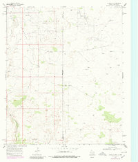
1969 Map of Eunice SE
USGS Topo · Published 1980About this map
Guinn Ranch stands as the primary residential landmark in this arid stretch of the High Plains, where the border between New Mexico and Texas is defined by the industrial expansion of the mid-century oil boom. The landscape is heavily marked by the Drinkard Oil Field, Paddock South Oil Field, and Nelson Oil Field, revealing an environment dominated by energy extraction. These fields are characterized by a dense network of drill holes, oil wells, and gravel pits, linked by an emerging infrastructure of access roads and a Jeep Trail. Topographically, the area is dissected by the long, dry path of Monument Draw, which snakes through the Freund Oil Field. The presence of the State Line Oil Field along the southern margin underscores how the Permian Basin's mineral wealth dictated the development of the Lea and Andrews county line long after initial settlement.
Find a feature on this map
16 named features on this map. Tap any name to fly to it.
Don’t see what you’re looking for? This feature index may not catch every label — zoom into the map to look around manually.
Map Details
Editions of this 1969 Eunice SE Map
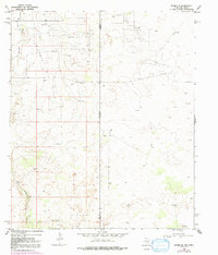
Other maps of this area

1954 · Hobbs
USGS Topo · 1:250,000

1958 · Hobbs
USGS Topo · 1:250,000

1969 · Jal NE
USGS Topo · 1:24,000

1969 · Eunice
USGS Topo · 1:24,000

1969 · Eunice NE
USGS Topo · 1:24,000

1969 · Eunice SE
USGS Topo · 1:24,000

1969 · Jal NW
USGS Topo · 1:24,000

1969 · Rattlesnake Canyon
USGS Topo · 1:24,000

1971 · Jumbo Hill
USGS Topo · 1:24,000

1971 · Figure Seven Ranch
USGS Topo · 1:24,000