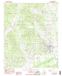
1983 Map of Eupora
USGS Topo · Published 1984About this map
Eupora stands as the central hub of this 1980s landscape, positioned at the junction of the Columbus and Greenville railroad and several local routes. The geography is defined by the transition from the hills around Sand Mountain and Rocky Mountain down toward the bottomlands of the Big Black River and its accompanying Canal. This survey documents a rural society deeply rooted in its local institutions, evidenced by the high density of country churches and cemeteries.
Find a feature on this map
41 named features on this map. Tap any name to fly to it.
Don’t see what you’re looking for? This feature index may not catch every label — zoom into the map to look around manually.
Map Details
Editions of this 1983 Eupora Map
2 editions found
Other maps of this area

1953 · Walthall
USGS Topo · 1:62,500

1953 · West Point
USGS Topo · 1:250,000

1958 · West Point
USGS Topo · 1:250,000

1963 · West Point
USGS Topo · 1:250,000

1966 · Stewart
USGS Topo · 1:24,000

1966 · Tomnolen
USGS Topo · 1:24,000

1968 · Weir
USGS Topo · 1:62,500

1972 · Sapa
USGS Topo · 1:24,000

1972 · Hohenlinden
USGS Topo · 1:24,000
1972 · Reform
USGS Topo · 1:24,000