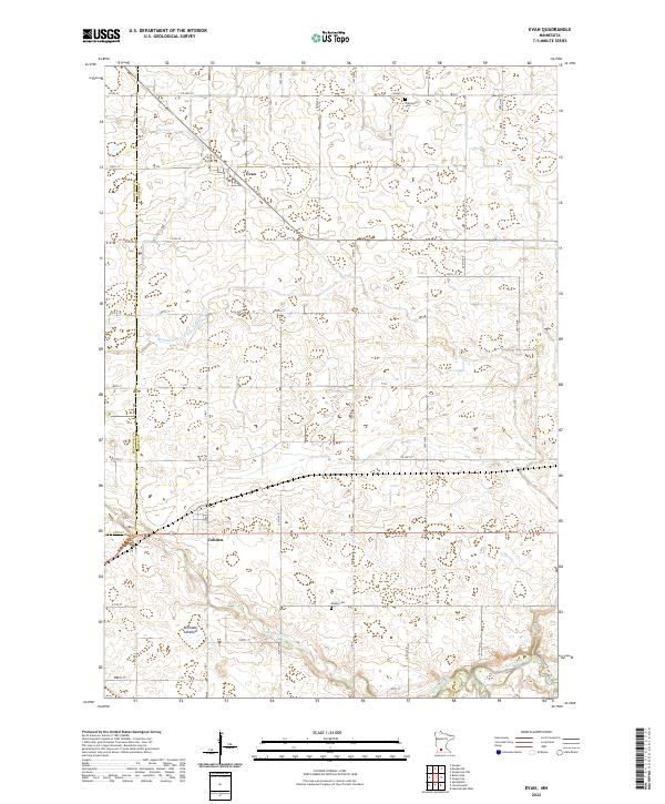
2022 Map of Evan
USGS Topo · Published 2022About this map
The village of Evan serves as a primary reference point in this agricultural landscape near the border of Redwood and Brown counties. A significant portion of the terrain is defined by its drainage and water systems, including the Redwood-Brown Ditch Number One and the meandering path of Sleepy Eye Cr, which flows toward the Cottonwood River in the southeastern corner. The presence of the Bloemke Lakebed indicates the region's post-glacial topography and history of local land reclamation for farming. For genealogists and local historians, the sheet identifies rural landmarks such as Prairieville Cem and Mielke Cem, which are situated among a rectilinear grid of county roads and township lines. The small settlement of Cobden provides another anchor for researchers looking at the development of small communities along the region's transport routes like Co Hwy 27.
Find a feature on this map
53 named features on this map. Tap any name to fly to it.
Don’t see what you’re looking for? This feature index may not catch every label — zoom into the map to look around manually.
Map Details
Editions of this 2022 Evan Map
This is the sole edition of this map. No revisions or reprints were ever made.
Other maps of this area

1953 · Morgan
USGS Topo · 1:62,500

1953 · New Ulm
USGS Topo · 1:250,000

1957 · New Ulm
USGS Topo · 1:250,000

1958 · New Ulm
USGS Topo · 1:250,000

1964 · Sleepy Eye NW
USGS Topo · 1:24,000

1964 · Sleepy Eye
USGS Topo · 1:24,000

1967 · New Ulm
USGS Topo · 1:250,000

1967 · Lake Hanska West
USGS Topo · 1:24,000

1967 · Springfield
USGS Topo · 1:24,000
1967 · Leavenworth
USGS Topo · 1:24,000