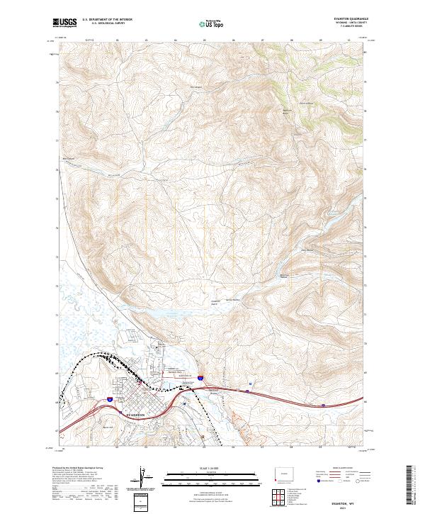
2021 Map of Evanston
USGS Topo · Published 2021About this map
Evanston sits as a vital high-desert hub where the Bear River meanders through the valley, flanked by the prominent heights of Medicine Butte and Burnt Hill. This 2021 survey details a landscape where historic water management remains visible through the City Ditch and Old City Ditch networks, essential for sustaining life in the arid terrain of Uinta County. The layout of the town is anchored by the Uinta County Courthouse, with neighborhoods extending along Front St and Main St.
Find a feature on this map
83 named features on this map. Tap any name to fly to it.
Don’t see what you’re looking for? This feature index may not catch every label — zoom into the map to look around manually.
Map Details
Editions of this 2021 Evanston Map
This is the sole edition of this map. No revisions or reprints were ever made.
Other maps of this area

1954 · Ogden
USGS Topo · 1:250,000

1958 · Ogden
USGS Topo · 1:250,000

1960 · Ogden
USGS Topo · 1:250,000

1965 · Evanston
USGS Topo · 1:24,000

1965 · Little Dee Creek
USGS Topo · 1:24,000

1965 · Sulphur Creek Reservoir
USGS Topo · 1:24,000

1965 · Guild Hollow
USGS Topo · 1:24,000

1965 · Three Forks
USGS Topo · 1:24,000

1965 · Millis
USGS Topo · 1:24,000

1968 · Wahsatch
USGS Topo · 1:24,000