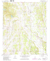
1966 Map of Evergreen
USGS Topo · Published 1979About this map
Tombigbee State Park anchors the northwest corner of this landscape, where the Campground and Park Headquarters sit near several active Sandpit sites. The terrain is defined by the winding paths of Boguefala Creek and Boguegaba Creek, which cross the border between Lee Co and Itawamba Co. Rural life in the mid-1960s is centered around a dense network of country churches and family burial grounds, including Andrews Chapel, Wesley Chapel Cem, and Pleasant Grove Ch.
Find a feature on this map
40 named features on this map. Tap any name to fly to it.
Don’t see what you’re looking for? This feature index may not catch every label — zoom into the map to look around manually.
Map Details
Editions of this 1966 Evergreen Map
3 editions found

Other maps of this area

1921 · Tupelo
USGS Topo · 1:48,000

1923 · Tupelo
USGS Topo · 1:62,500

1956 · Tupelo
USGS Topo · 1:250,000

1958 · Tupelo
USGS Topo · 1:250,000

1965 · Mooreville
USGS Topo · 1:24,000

1965 · Fulton
USGS Topo · 1:24,000

1966 · Smithville
USGS Topo · 1:24,000

1966 · Beans Ferry
USGS Topo · 1:24,000

1966 · Shannon
USGS Topo · 1:24,000
1966 · Nettleton
USGS Topo · 1:24,000