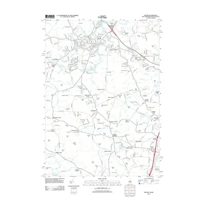
2012 Map of Exeter
USGS Topo · Published 2012About this map
The Squamscott River and Exeter River define the northern hydrology of this 2012 survey, where suburban expansion meets the longstanding agricultural character of Rockingham County. Settled points like Kensington and South Hampton are anchors for a landscape punctuated by historic "corner" settlements, including Brick School Corner and Town Hall Corner. These traditional place names reveal an older pattern of rural organization centered on local crossroads and civic infrastructure.
Find a feature on this map
268 named features on this map. Tap any name to fly to it.
Don’t see what you’re looking for? This feature index may not catch every label — zoom into the map to look around manually.
Map Details
Editions of this 2012 Exeter Map
This is the sole edition of this map. No revisions or reprints were ever made.
Other maps of this area

1888 · Newburyport
USGS Topo · 1:62,500

1888 · Haverhill
USGS Topo · 1:62,500

1890 · Haverhill
USGS Topo · 1:62,500

1890 · Newburyport
USGS Topo · 1:62,500

1893 · Dover
USGS Topo · 1:62,500

1893 · Haverhill
USGS Topo · 1:62,500

1894 · Newburyport
USGS Topo · 1:62,500

1916 · Dover
USGS Topo · 1:62,500

1917 · Mt. Pawtuckaway
USGS Topo · 1:62,500

1918 · Dover
USGS Topo · 1:62,500