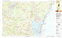
1987 Map of Exeter
USGS Topo · Published 1987About this map
Exeter serves as a prominent inland hub where the Exeter River meets the Squamscott River, defined by its educational and industrial foundations. The campus of Phillips Exeter Academy occupies a significant portion of the town's western landscape, while the historic rail corridor of the Boston and Maine links the settlement to the coastal communities of Hampton and Seabrook. Toward the Atlantic, the landscape transitions into the tidal systems of Hampton Harbor and the Blackwater River, where the Seabrook Power Plant is shown during its late 20th-century construction phase.
Find a feature on this map
178 named features on this map. Tap any name to fly to it.
Don’t see what you’re looking for? This feature index may not catch every label — zoom into the map to look around manually.
Map Details
Editions of this 1987 Exeter Map
This is the sole edition of this map. No revisions or reprints were ever made.
Other maps of this area

1888 · Newburyport
USGS Topo · 1:62,500

1888 · Haverhill
USGS Topo · 1:62,500

1890 · Haverhill
USGS Topo · 1:62,500

1890 · Newburyport
USGS Topo · 1:62,500

1893 · Dover
USGS Topo · 1:62,500

1893 · York
USGS Topo · 1:62,500

1893 · Haverhill
USGS Topo · 1:62,500

1894 · Newburyport
USGS Topo · 1:62,500

1916 · Dover
USGS Topo · 1:62,500

1917 · Mt. Pawtuckaway
USGS Topo · 1:62,500