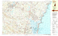
1992 Map of Exeter
USGS Topo · Published 1998About this map
The Squamscott River and Exeter River define the northern landscape of this coastal survey, where the historic campus of Phillips Exeter Academy sits near the heart of Exeter. In the south, the industrial presence of Seabrook Station near the Hampton Harbor Inlet contrasts with the surrounding wetlands of Great Meadows and the salt marshes of Hampton Harbor. The coastline is densely marked with landmarks like Great Boars Head and North Beach, while the interior shows a transition from the structured street grids of established towns to a network of rural corner settlements like Eastman Corners and Sanborn Corners. Local industry is evidenced by sites such as Coffins Mill and Weares Mill, alongside the transportation corridor of the B & M RR. Extensive conservation areas, including Hampton Beach State Park and Powwow River State Forest, preserve the natural character of the Rockingham County shore as it appeared in the early 1990s.
Find a feature on this map
145 named features on this map. Tap any name to fly to it.
Don’t see what you’re looking for? This feature index may not catch every label — zoom into the map to look around manually.
Map Details
Editions of this 1992 Exeter Map
This is the sole edition of this map. No revisions or reprints were ever made.
Other maps of this area

1888 · Newburyport
USGS Topo · 1:62,500

1888 · Haverhill
USGS Topo · 1:62,500

1890 · Haverhill
USGS Topo · 1:62,500

1890 · Newburyport
USGS Topo · 1:62,500

1893 · Dover
USGS Topo · 1:62,500

1893 · York
USGS Topo · 1:62,500

1893 · Haverhill
USGS Topo · 1:62,500

1894 · Newburyport
USGS Topo · 1:62,500

1916 · Dover
USGS Topo · 1:62,500

1917 · Mt. Pawtuckaway
USGS Topo · 1:62,500