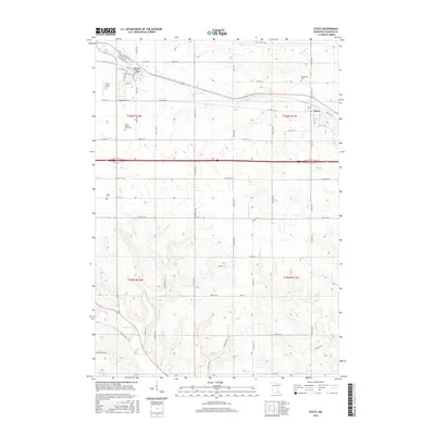
2016 Map of Eyota
USGS Topo · Published 2016About this map
Eyota and Dover anchor this portion of Olmsted County, illustrating the agricultural and residential patterns of southeastern Minnesota. The terrain is defined by the drainage systems of the S Fork Whitewater River, Mill Cr, and Lunch Cr, which carve through the land south of the primary settlements. Genealogical interest is particularly high given the presence of several distinct burial grounds, including the Evergreen Cem near Dover and the smaller Edith Wright Farm Cem and Cline Cem situated among the farmsteads. These family-named landmarks and rural cemeteries provide a direct link to the area's early landowning history. The map also captures the layout of the Eyota Airport and the local road network, from named streets like Rena Belle St to the grid of secondary routes that connect the various townships.
Find a feature on this map
64 named features on this map. Tap any name to fly to it.
Don’t see what you’re looking for? This feature index may not catch every label — zoom into the map to look around manually.
Map Details
Editions of this 2016 Eyota Map
This is the sole edition of this map. No revisions or reprints were ever made.
Other maps of this area

1934 · Plainview
USGS Topo · 1:62,500

1935 · Rochester
USGS Topo · 1:48,000

1938 · Plainview
USGS Topo · 1:62,500

1939 · Rochester
USGS Topo · 1:62,500

1953 · Saint Paul
USGS Topo · 1:250,000

1954 · Chatfield
USGS Topo · 1:62,500

1954 · Mason City
USGS Topo · 1:250,000

1955 · Stewartville
USGS Topo · 1:62,500

1957 · Mason City
USGS Topo · 1:250,000

1958 · Mason City
USGS Topo · 1:250,000