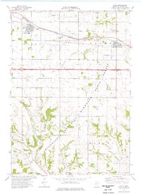
1974 Map of Eyota
USGS Topo · Published 1976About this map
Agricultural tablelands meet the dissected coulee country of southeastern Minnesota in this 1974 snapshot of Olmsted County. The village of Eyota serves as a local hub along the Chicago and North Western rail line, which also passes through Dover to the east. The landscape transitions from the flat prairie townships in the north to the deeply carved valleys of the Minnesota Memorial Hardwood State Forest in the south, where Mill Creek and Lynch Creek flow through the township of Elmira. Evidence of earlier transit is preserved in the Old Railroad Grade cutting across the central hills. Local genealogy is anchored by the Evergreen Cem and Cline Cem, while the presence of scattered Quarries and a Gravel Pit indicates the importance of local stone and aggregate to the regional economy during the mid-1970s.
Find a feature on this map
24 named features on this map. Tap any name to fly to it.
Don’t see what you’re looking for? This feature index may not catch every label — zoom into the map to look around manually.
Map Details
Editions of this 1974 Eyota Map
This is the sole edition of this map. No revisions or reprints were ever made.
Other maps of this area

1934 · Plainview
USGS Topo · 1:62,500

1935 · Rochester
USGS Topo · 1:48,000

1938 · Plainview
USGS Topo · 1:62,500

1939 · Rochester
USGS Topo · 1:62,500

1953 · Saint Paul
USGS Topo · 1:250,000

1954 · Chatfield
USGS Topo · 1:62,500

1954 · Mason City
USGS Topo · 1:250,000

1955 · Stewartville
USGS Topo · 1:62,500

1957 · Mason City
USGS Topo · 1:250,000

1958 · Mason City
USGS Topo · 1:250,000