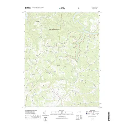
2019 Map of Ezel
USGS Topo · Published 2019About this map
The Daniel Boone National Forest dominates the terrain of this Morgan County region, where the steep hollows of the Cumberland Plateau have shaped a landscape of dispersed rural settlements. Communities like Ezel, Kellacey, and Artville are linked by winding roads that follow the high ridges or narrow creek bottoms. The geography is defined by a dense network of watercourses, including Blackwater Creek, Open Fork, and the descriptive Broke-Leg Creek, which features the notable Broken Leg Falls. Genealogy researchers will find a significant number of family burial grounds scattered across the ridges, such as Cecil Cem, Whitaker Cem, and Goad Cem. The map illustrates a traditional Kentucky mountain settlement pattern, where narrow valley floors provide just enough space for small communities like Ebon and Dan to reside between the forested heights of Big Woods and Goad Ridge.
Find a feature on this map
97 named features on this map. Tap any name to fly to it.
Don’t see what you’re looking for? This feature index may not catch every label — zoom into the map to look around manually.
Map Details
Editions of this 2019 Ezel Map
This is the sole edition of this map. No revisions or reprints were ever made.
Other maps of this area

1889 · Salyersville
USGS Topo · 1:125,000

1891 · Salyersville
USGS Topo · 1:125,000

1892 · Beattyville
USGS Topo · 1:125,000

1899 · Salyersville
USGS Topo · 1:125,000

1929 · Morehead
USGS Topo · 1:48,000

1929 · Salt Lick
USGS Topo · 1:62,500

1934 · Salt Lick
USGS Topo · 1:62,500

1935 · Morehead
USGS Topo · 1:62,500

1951 · Cannel City
USGS Topo · 1:24,000

1951 · Ezel
USGS Topo · 1:24,000